Crafting the Architectural Measured Drawings
BRIEF INTRODUCTION
For centuries, measured drawings have been the major communication medium to acquire an understanding of the built environment and to deliver ideas of construction and design. The value of measured drawings as educational tools to learn about the architectural context as well as signifiers of the cultural values have transcended the importance of these two-dimensional illustrations as ephemeral depictions of building forms and materials. In the midst of an architectural culture increasingly utilizing three-dimensional virtual surrogates along with the state-of-the-art surveying and representation methodologies, however, the production of measured drawings have been relegated to a narrower focus in the documentation projects. The methodological path to produce measured drawings carries similar traits with how ethnographers create thick descriptions of cultural signifiers. Reflecting on measured drawings as an account of “thick description,” this essay addresses architectural documentation.
Keywords measured drawings HABS surveying laser scanning Clifford Geertz
Architects’ drawings, either focusing on existing materials or projecting imagined ideas, are analytical and interpretive. The process of drawing includes a mental cycle of documenting, seeing, knowing, and experiencing. The Italian architect Carlo Scarpa (1906-1978) famously stated that drawing allows him to see: “I place things in front of me, on the paper, so I can see them. I want to see, therefore, I draw. I can see an image only if I draw it.”1 Making drawings of the built environment, in this context, is often considered as simply a technique of basic visualization of the existing architectural fabric and a passive form of recording.2 Drawing and documenting, on the contrary, have a long tradition in the architectural culture, which allow architects to conceive existing building forms and materials, and to develop design inquiries.

Even though associated with stark modernist design, Charles Edouard Jeanneret (Le Corbusier, 1887-1965), for example, distinctively emphasized the value of learning by measuring and drawing the existing architectural examples.3 The development of Le Corbusier’s distinct style stems from his travels to Europe and Mediterranean between 1907 and 1911, where he constantly made sketches of his surroundings. Le Corbusier’s passion of exploration of the pleasing spatial relationships as well as structural qualities culminated in a series of magnificent drawings of ancient ruins, details of interior spaces, and landscapes, annotated with careful notes and dimensions. In his writings, Le Corbusier even advised carrying a tape measure to check the prevailing geometric guides as the sources of architectural design.4 Le Corbusier’s sketches involve a process of abstraction of the inherent attributes of the architectural context, as investigations of mass, surface, and plan, articulated in his widely recognized book Towards a New Architecture.5
DRAWING THE BUILT ENVIRONMENT
In the architectural culture, two-dimensional measured drawings are the formalized product of documentation, which are produced for preservation pursuits. Measured drawings are made years after a building is constructed, showing the existing condition of the architectural setting at the time of documentation. Figure 1 illustrates a measured drawing of the Montezuma Castle, Camp Verde, Arizona, U.S. delineated in 2003. The elevation drawing shows a cliff dwelling, constructed by Sinagua people in the late twelfth century. Having a measurable record of the architectural heritage, such as the depiction of the vertical qualities of the façade of the castle, provides the information to understand the significance of the heritage fabric, to record the existing conditions of the asset, and to interpret the qualities for informed decisions on the preservation of the built environment.


Although Le Corbusier’s favorite recording apparatus of tape measure is still a part of the documentation toolbox, to provide an accurate measurable surrogate of the built environment, architects extensively use advanced recording and documentation practices. Methodologies such as photogrammetric devices, three-dimensional laser scanners, and total station instruments enable inquirers to collect highly accurate measurements from the surfaces remotely. The exactitude of the digital field data has significant advantages in a preservation project because the virtual surrogate can be translated into different formats, such as a template for measured drawings, volumetric input for mass analyses, or metric data to calculate structural deformations. To collect measurements, moreover, considerably reduces the cost of the fieldwork since inquirers can undertake a building survey in a couple of days fieldwork compared to weeks long hand measuring.
INTERPRETING THE THREE-DIMENSIONAL WORLD THROUGH TWO-DIMENSIONS
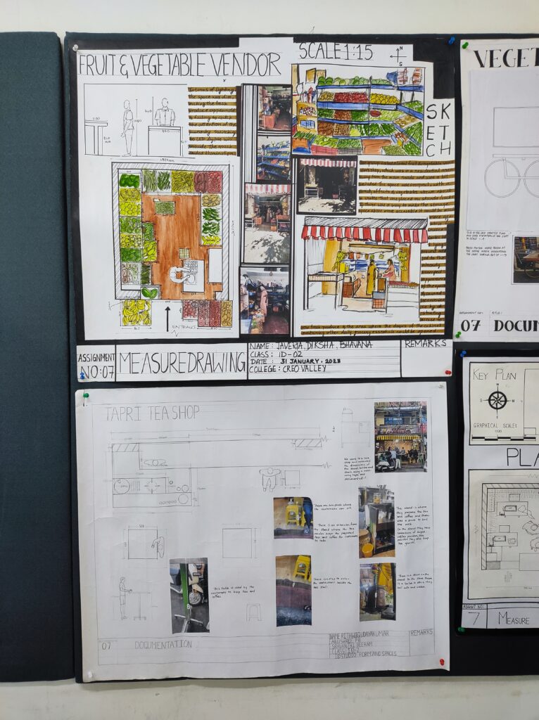
Merriam Webster’s states that a measured drawing is “an architectural scale drawing of an existing structure.” The measured drawing is a snapshot of the architectural context at the time of documentation, meaning that architects record the dimensional, material, and structural details of the building and delineate these qualities “true to nature.” Each drafted line in the plan drawing of the concession building located on the Liberty Island, New York City, New York (Fig. 2), for example, correspond to a cluster of measured points on a structural element, such as a wooden trim or a door opening, where architects carefully collected measurements from the historic surfaces and then transposed their notes to the graphical representation.
If you care to learn further about how projects & workshops are structured at LISAA School of Design, please click below to get in touch with our team.