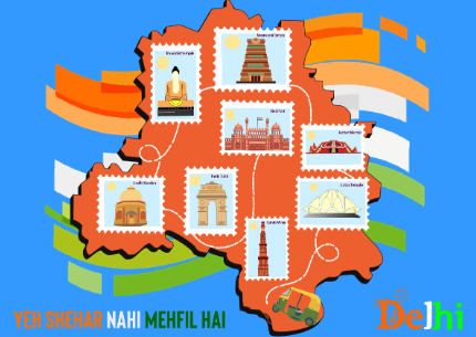
Map Illustration
Map illustration is an exciting design exercise. Illustrated maps can be filled with character and fun details to truly capture the atmosphere of a city, state, or country. Creating your own map illustrations is a challenging exercise in composition, but can be a great addition to your design portfolio. Creating an illustrated map can be a great way of bringing a city, country, or state to life as well as a wonderful way of remembering your favorite place.
First you need to decide the location for your illustrated map. This could be your favorite city or perhaps your last holiday destination – just make sure there are lots of interesting iconic landmarks to choose from.
Small details such as buildings, road signs and trees help fill any remaining space and bring the whole map together. Double-check your colors and make sure everything is harmonizing.
Map illustration has had a real resurgence over the past few years. An exciting alternative to a dry Google map, illustrated maps can be filled with character and fun detail to truly capture the atmosphere of a city. Creating your own map illustrations is a challenging exercise in composition, but can be a great addition to your design portfolio.
In this exercise, students had to choose one Indian state and create a tour map illustration or poster based on its famous places, culture, and art. With this exercise, LISAA School of Design Second year Graphic Design students learned about the Graphic design process from research to the finished illustration.
If you care to learn further about how workshops are structured at LISAA School of Design, please click below to get in touch with our team.